
General Information
Kaipara District is located in the Northland region, of the North Island. The Kaipara is the largest harbour in the southern hemisphere, where it’s waters have provided food and shelter to settlers for generations. Kaipara Harbour is one of Northland’s best kept secrets. Dargaville ‘the kumara capital’ is the gateway to Waipoua Forest, making it the heart of the Kauri Coast, and offers kauri and historical marine heritage.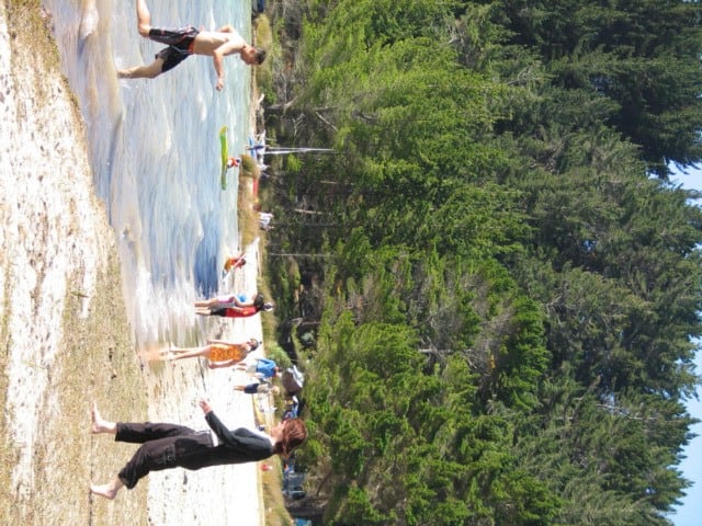 Kai Iwi Lakes.
Kai Iwi Lakes has a camping ground and is handy to all attractions and services offered in the Western area of the Kaipara District.
Maori Translation of Kaipara
The Māori meaning of Kaipara:
Kai – food
para – fern root
Kumara – sweet potato brought here by the early Māori settlers.
Attractions
The Kauri Coast is an outdoors playground which attracts large numbers of holiday makers, and visitors every year.
Kaiwaka is the southern gateway to the Kauri Coast, offering a variety of shops, cafes and friendly accommodation. At night this ‘little town of lights’ welcomes travellers with hundreds of tiny twinkling lights.
Don’t miss Tane Mahuta ‘God of the Forest’ the largest kauri tree in New Zealand standing guard over Waipoua Forest, and has become an icon of New Zealand’s unique natural heritage.
The crystal clear Kai Iwi Lakes, just half an hour north from Dargaville where you can pitch your tent in the camping ground, or stay in a cottage. With the lakes and surrounding landscape you can indulge in walking, swimming, sailing, wind surfing or even flick a fly rod and try to catch a trout. See Ripiro Beach – New Zealand’s longest driveable beach at 100kms, and the majestic Pouto Point.
Shopping
The Kaipara District offers an assortment of retail opportunities. The main shopping centre is Dargaville where you will find a wide variety of shops, cafes, restaurants and bars. The smaller townships also cater for the traveller, making your stop enjoyable.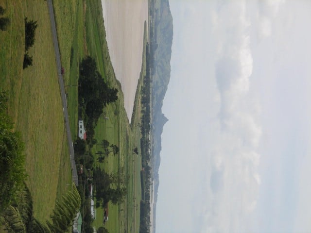 Vista from Dargaville to Toka Toka Peak
Geography
The Kaipara District is located in the hills around the northern shores of the Kaipara Harbour, a large natural harbour opening to the Tasman Sea. The district stretches from Maungaturoto in the south to the Waipoua Forest in the north, and extends from there down the west coast to the Kaipara Harbour.
History
The Ngati Whatua and Ngapuhi were the first to arrive in the Kaipara, in their canoe Mahuhu-o-Te-Rangi.
They lived off the land, snaring wood pigeon, kiore and fishing.
There was relative peace until 1807, when one of the fiercest battles took place at Moremonui, south of Maunganui Bluff. The Ngati Whatua, led by the great chiefs Rangatira Taoho and Murupaenga, all but annihilated the Ngapuhi. Chief Taoho drew a line across the beach, which no one could cross to chase the fleeing Ngapuhi. In 1825 a survivor of the massacre at Moremonui, Hongi Hika got revenge on the Ngati Whatua in a major battle at Kaikohe.
In the early 1800’s sailing ships arrived in the Kaipara, in search of Kauri. With the begining of commercial practices in Kaipara, timber mills began operating, and soon lined the shorelines of the harbour. The trade in timber and gum increased and the Kaipara Harbour became extremely busy with ships, sometimes as many as twenty ships left the harbour on the one tide.
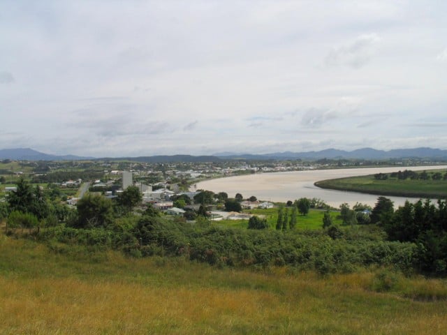 Northern Wairoa River.
The Northern Wairoa River is a commanding feature of the Dargaville township.
Missionaries arrived in 1817, the first being Samuel Marsden and a mission started at Okara Point in 1820.
Slowly more settlers flowed into the Kaipara, coming from Auckland, Helensville, Bay of Islands and Whangarei. In the 1840’s, the Albertlanders from England settled in the Port Albert area where the name Albertlanders originates from. Majority of these people were timber merchants, looking to make a living from Kauri logging.
With the demise of the once great and plentiful Kauri in the late 19th century, the timber trade ceased, so the trade shifted to Kauri gum. The gum was dug from swamps in the district and lasted from 1853 to 1951. More immigrants arrived, of note the Dalmatians, who had left war torn Yugoslavia to find peace and prosperity. They spread themselves out in the Kaipara District and the Far North.
When both the timber and gum trades finished, the areas mainstay became farming and cropping that continues today.
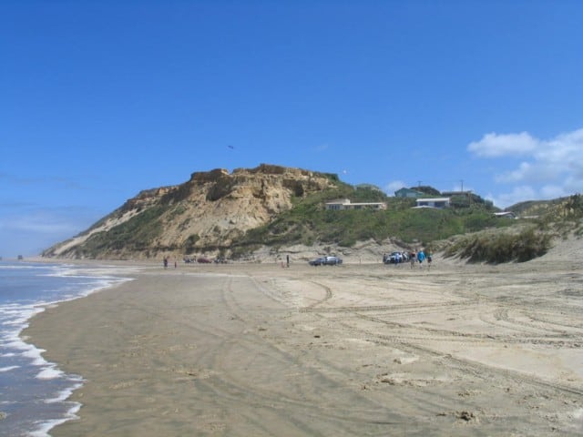 Baylys Beach.
Baylys Beach on the West Coast from Dargaville is popular for leisure and adventure pursuits.