
Tokatoka Peak
General Information
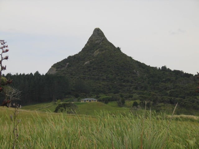
Tokatoka Peak is a residual volcanic cone, situated on the Ruawai flats in the Kaipara District. To find Tokatoka take the Tokatoka Road, off SH12, 17 km south of Dargaville. The entrance is signposted 1 km along Tokatoka Road.
Attractions and Activities
Tokatoka Peak is a rare volcanic phenomenon, and is easily recognised by its sharp symmetrical shape, standing 180metres tall. It is a 20-minute walk which climbs steadily all the way, with a steep short climb to the summit, where you will enjoy expansive views.
In winter the track is wet and suitable footwear is required.
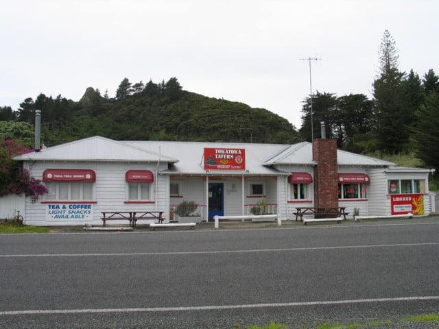
Tokatoka Tavern
The local watering hole.
Maori Mythology of Tokatoka
Maori mythology talks about the mountains Manaia, Maunga, Raho and Tokatoka, who once stood together in the ancestral land Hawaiki. Manaia urged them to travel across the ocean to New Zealand, so they raced across, but as the sun rose they were frozen. Then they were separated, Manaia stands at Whangarei, Maunga Raho, and Tokatoka are on the North Branch Wairoa River.
Maori Translation
Tokatoka – rocks upon rocks.